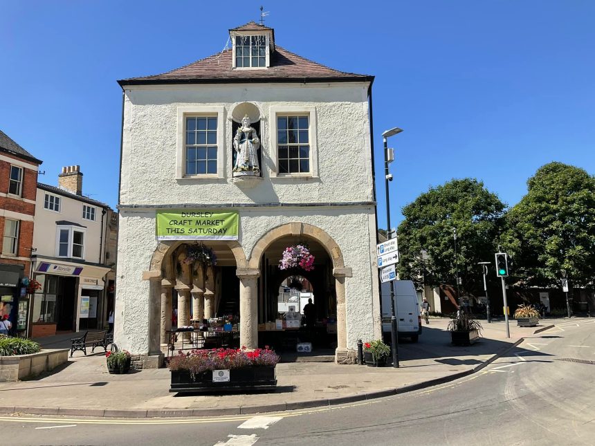
Dursley is an old market town in the heart of the Cotswold hills, with its 18th-century market hall, raised on pillars like stilts. Dursley was once a hub of the cloth-making industry that supported so many Cotswold villages and there are many older houses that stand as a testament to Dursley’s former prosperity.
There are 12 routes to explore the Cotswolds from Dursley
Wednesday, 2nd September, 2026 – Start: 10:00 am
North Nibley: Into Waterley Bottom
| Length | 6 miles |
| Difficulty | May be steep slopes, moderate fitness |
Tuesday, 11th August, 2026 – Start: 10:00 am
Stinchcombe to Stancombe scenic circuit
| Length | 4.5 miles |
| Difficulty | May be steep slopes, moderate fitness |
Thursday, 2nd July, 2026 – Start: 10:00 am
CNL60:LASBOROUGH AND OZLEWORTH-FIVE HOUSES, THREE VALLEYS
| Length | 8.5 miles |
| Difficulty | May be steep slopes, moderate fitness |
Wednesday, 8th July, 2026 – Start: 10:00 am
Dursley: Just two peaks
| Length | 6 miles |
| Difficulty | May be steep slopes, moderate fitness |
Saturday, 18th July, 2026 – Start: 10:00 am
Kingscote to Ozleworth ramble
| Length | 7.5 miles |
| Difficulty | May be steep slopes, moderate fitness |
Wednesday, 27th May, 2026 – Start: 10:00 am
Selsley Common Children's Nature Walk
| Length | 1.5 miles |
| Difficulty | May be steep slopes, moderate fitness |
| Mobility aid rating | Stile free |
Monday, 24th August, 2026 – Start: 10:00 am
Beverston: Let's enjoy our Heritage of Castle, House & Cave
| Length | 5.5 miles |
| Difficulty | Unsurfaced paths, basic fitness |
Monday, 18th May, 2026 – Start: 10:00 am
Coffee Morning Walk - Sylvan Glades and a Steep Hill around Kingscote
| Length | 5.5 miles |
| Difficulty | May be steep slopes, moderate fitness |
Tuesday, 12th May, 2026 – Start: 10:00 am
The 3 'V's of Woodchester plus a section of the Cotswold Way
The Valley, Vineyard and Views of Woodchester Park plus Selsley and Stanley Woods
| Length | 8.5 miles |
| Difficulty | Uneven, steep slopes, good fitness |
Saturday, 11th April, 2026 – Start: 10:00 am
Cam Peak - Bluebells and Vistas
Cam Peak circular walk via Cam Long Down
| Length | 3.0 miles |
| Difficulty | May be steep slopes, moderate fitness |
Thursday, 19th March, 2026 – Start: 10:30 am
CNL60 - Uley: Third Thursday Walk - Weaving Around Uley
A two hour walk exploring the environs of Uley and its key role in the local woollen industry.
| Length | 5.0 miles |
| Difficulty | May be steep slopes, moderate fitness |
Friday, 27th March, 2026 – Start: 10:00 am
Avening: Gatcombe View and Secluded Valley
A circular walk across varied landscapes giving glorious views of the Gatcombe Estate and providing the peace of a hidden valley.
| Length | 7.5 miles |
| Difficulty | May be steep slopes, moderate fitness |