Newton St Loe (Timsbury Walk 1)

Walks 1 and 2 are two of the twenty walks set in the beautiful countryside close to Timsbury in a book supported by Timsbury Parish Council.

Distance

2 miles / 3.22 km

Duration

1 hours

Difficulty

Unsurfaced paths, basic fitness

Mobility aid rating

Stile free

Shape

Circular

Start

Address

The Hayes, 8 Hayes St, The Hayes, Newton St Loe, Bath BA2 9BU, UK
View start on Google Maps

OS Grid Ref

ST701649

What3Words

sticks.vies.ranges

Travel Info

Park on the road near the church.

Navigation

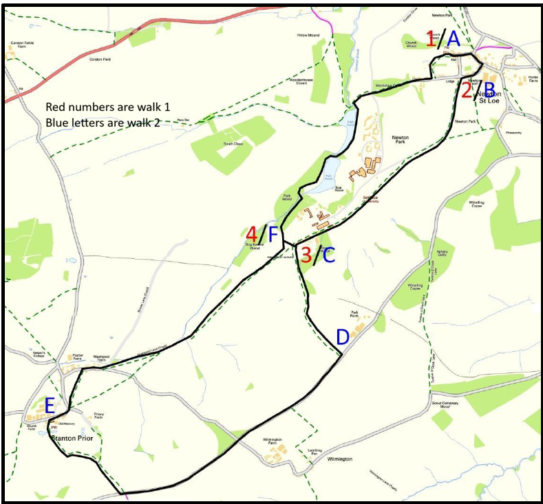
1 With the church behind you walk down the road passing the School House on your right. Pause in front of the School House to read the inscription above the door. Ignore the turning going right after the School House and continue straight ahead passing the regional office of the Duchy of Cornwall. Turn right at the T-junction, passing The Mount on your left, to reach the centre of the village. Turn right down the side of the thatched cottage keeping the island with the tree on your left. Follow the lane passing a playground on your left for 150 yards until you reach a crossroads. Turn left through metal pillared gates beside The Lodge.

2 Go over the cattle grid heading towards Bath Spa University. Continue ahead on the road for 450 yards and go over another cattle grid. Continue on the road then take the metal kissing gate on the left. Turn immediately right and walk across the field keeping the barbed wire fence on your right. Head slightly left towards a metal kissing gate 30 yards before the end of the road. Continue in the same direction across the field, past the original Newton Park house on your right. Continue through the parkland in the same direction keeping the road on your right and aiming to the left-hand side of the car park ahead. Walk down the side of the car park to reach a metal kissing gate and the metal field gate in the corner of the field by the buildings. Continue ahead keeping buildings on your right towards a signpost. Carry on ahead keeping the walled garden on your left; on the way you can look into the walled garden.

3 At the end of the walled garden wall, bear right to the end of an avenue of trees and then take the metal kissing gate to the right.

4 Pass through the wooden gates into the woods and follow the gravel path. At the T-Junction of paths turn left and cross a bridge over the Corston Brook. Continue on the path as it bends round the lake, passing a Garden Temple on the left. At the end of the lake there is a weir that goes down to the second lake. There is an ice house to the left of the weir. At the end of the lake there is a good view of the old castle on the hill at the opposite end of the lake. Continue on the path and as you reach the metal gates in front of you turn left on the narrow path downhill to the stream. Go through the metal kissing gate and continue along the edge of the lake.

Pass the man-made waterfalls on your left to reach a double metal kissing gate. After the kissing gates, turn right and walk on the path towards the drive to the University. Go through the gap beside the metal field gate (the kissing gate is not in use), cross the drive to the gap into the Bathampton Anglers’ car park opposite. Go across the car park and follow the tarmac footpath ahead. The footpath then joins the road. Continue along this road, passing the Send a Cow Project on the right. At the twenty mile per hour sign and footpath sign turn left. Turn right after the garage and go through the metal kissing gate. Walk straight ahead to the church and another metal kissing gate into the churchyard. Go past door to the church, through gates to reach the start of the walk.